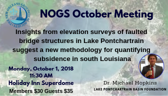
ABSTRACT: One contributor to land loss in Louisiana is subsidence driven by active faulting; however, rates of vertical motion due to faulting are poorly constrained in coastal Louisiana. At least three faults associated with the Baton Rouge-Denham Springs Fault System in Lake Pontchartrain are actively deforming man-made structures. Six automobile bridges span the lake and intersect these fault traces. The bridges are supported on pilings, which were driven into well-consolidated Pleistocene clays, so measured offsets are from faulting over the last 90 years and not Holocene compaction. High-resolution elevation data were acquired on all structures by walking or driving the road surface or measuring elevations on pilings by boat. Depending on how and where offsets are measured across the faults, rates of subsidence can vary from 1.5 to 2.8 mm/yr (0.06-0.1 in/yr.). These patterns and calculated rates reveal that coastal neotectonic processes contribute to subsidence in a more complex way than currently envisioned by the Louisiana Coastal Master Plan (CMP). Previous work has shown that subsidence may be caused by as at least eight natural processes (e.g. natural faulting) and at least six anthropogenic processes (e.g. fluid withdrawal). Any particular area of the Louisiana coast is not subject to all these processes. However, all areas of the coast are subject to some combination of them, which contributes to the local subsidence vector in unique and variable amounts over time. Understanding future land surface and water bottom elevations of Louisiana coastal area is critical to coastal planning but highly problematic. Rather than considering subsidence as a single rate over a broad region, as currently done in the Louisiana CMP, each contributor should be considered individually. A range of rates, based on statistical probabilities from experts and models, can be assigned to each process over a geographical extent. The individual rates are then summed yielding in a cumulative subsidence rate for any given location. The resultant product is envisioned to be a grid with each cell value representing the sum of the individual processes. The grid would be dynamic and can be updated regularly as new data emerge. This study highlights the complexities in measuring current and predicting future rates of subsidence and suggests a new perspective on subsidence for planning purposes is needed
MORE ABOUT DR. HOPKINS: Dr. Michael Hopkins is a Gulf Coast native originally from Biloxi, Mississippi. I completed my undergraduate degree in geology at the University of Southern Mississippi in 2010 and a Ph.D. in earth and environmental sciences at Tulane University in 2016. My graduate researched focused on understanding extensional fault growth and interaction and how that interaction is transferred to and preserved in the landscape. Since 2016, I have been on staff with the Lake Pontchartrain Basin Foundation as a geologist and GIS specialist. While at LPBF I have worked on a variety of projects. One topic that my work at LPBF has focused on is how faults contribute to subsidence in coastal Louisiana.